
 Today we woke up pretty early to do the Navajo / Queen’s Garden Loop trail. We drove to the parking lot at Sunrise Point and there was hardly anyone there. It was about 7 degrees so we layered up, grabbed our snacks and hit the trail.
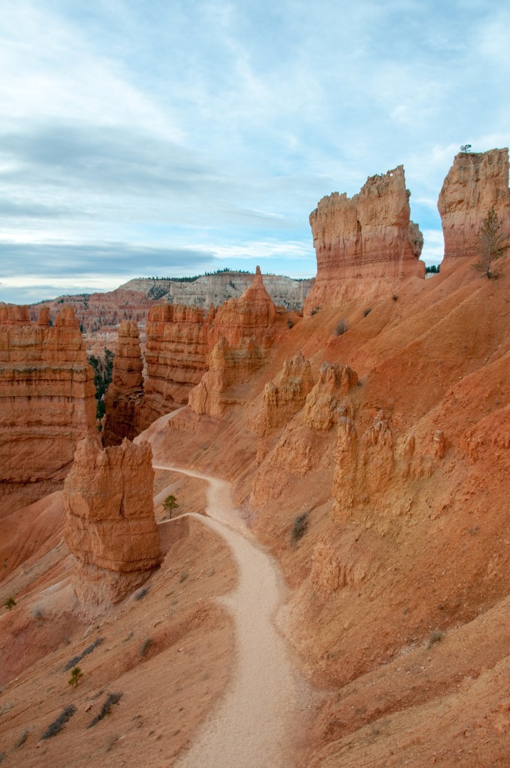
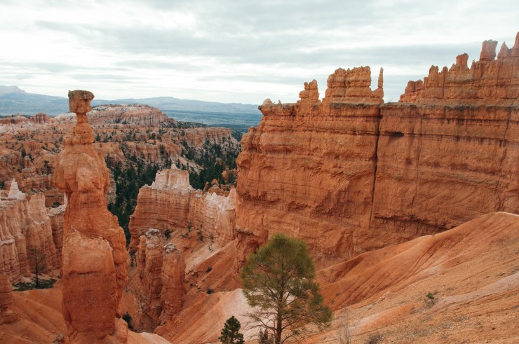
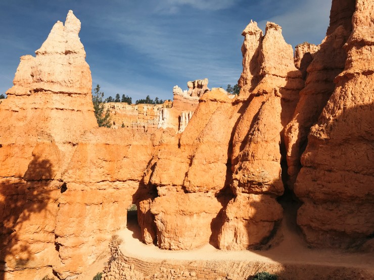
The trail starts with a gradual descent into the canyon. You can see the famous “Thor’s hammer” hoodoo early on in the hike. Early on into the hike you go down a set of switchbacks with a bunch of trees in the middle. I have seen photos of Wall Street on this trail but unfortunately it was still closed for winter.
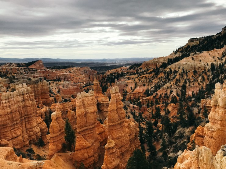
Descending into the canyon you feel tiny! There is also a small sense of worry that you will have to climb back up eventually.
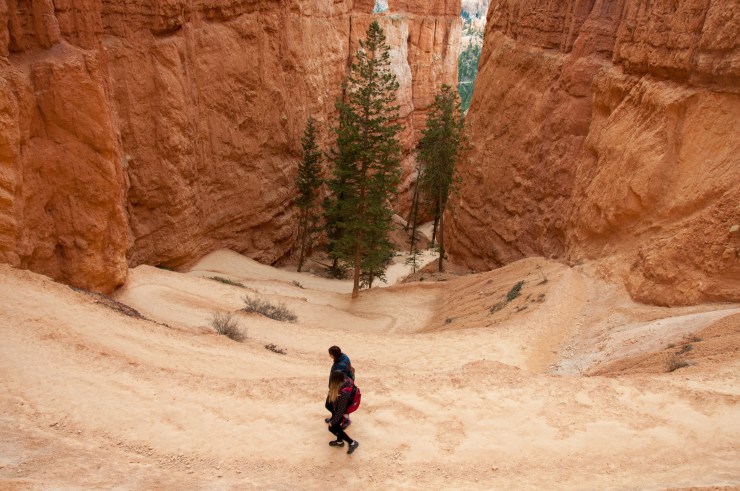
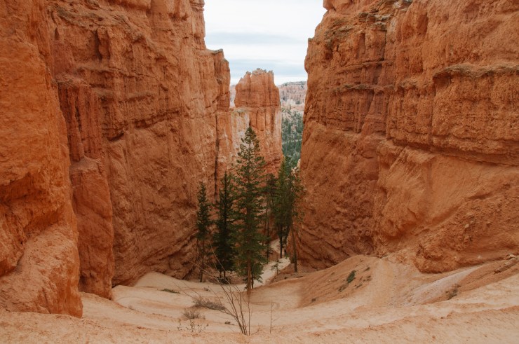
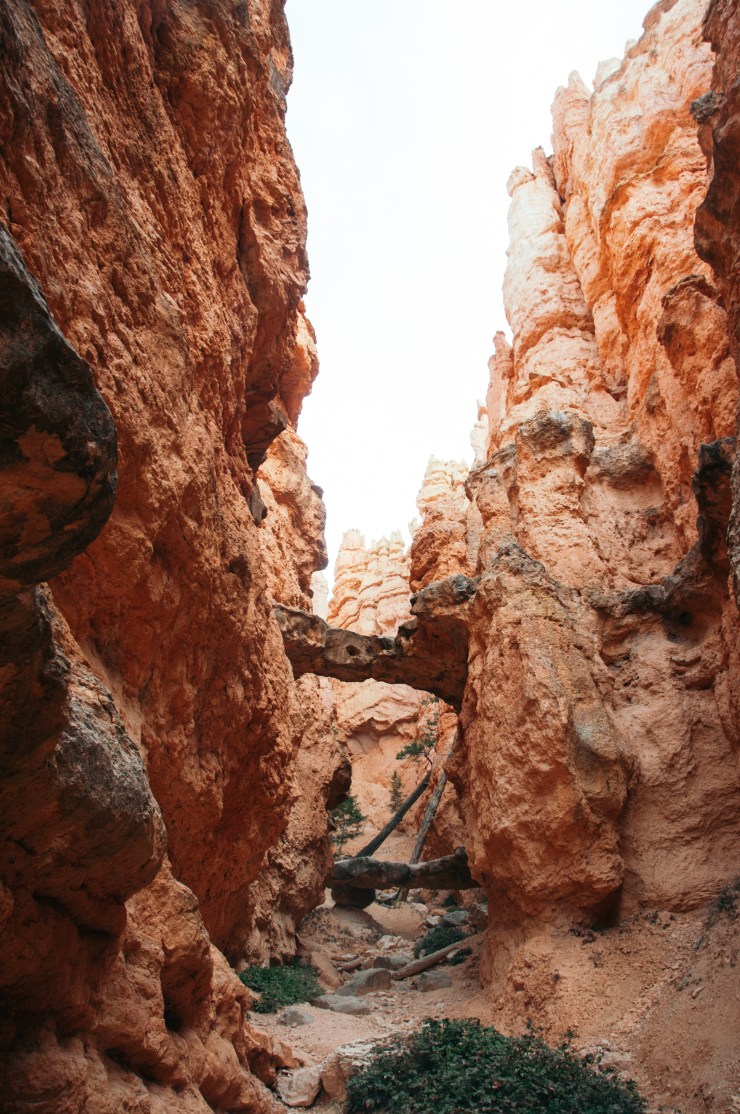
Once you reach the bottom of the canyon you pass by a cool formation called “two bridges” and then you walk through a forest like section. The forest is mostly flat and a nice break from the steep grades.
I didn’t take many photos after this area since the scenery was pretty much the same the whole way through. Once you pass through the forest you will reach Queen’ Garden, another section of trail that features a lot of cool bridges and more hoodoos.
Apparently I put away my dslr at this point and only used my phone for photos!
Good news! this trail was a lot easier than I anticipated. After hiking out of part of the Grand Canyon I guess I was more prepared. This trail is 4.2 kilometres (2.6 miles) and only took a few hours with lots of photo stops and a few breaks so it makes a great morning hike. The trail ends at Sunset Point which is just a short walk back to the car.
After completing this hike we drove just outside the park to do the Mossy Cave hike. This is right on the side of the road and super easy to miss but worth a quick stop. I won’t go into too much detail but it features a small waterfall and a “mossy cave” which was a bit of a non event to be honest.
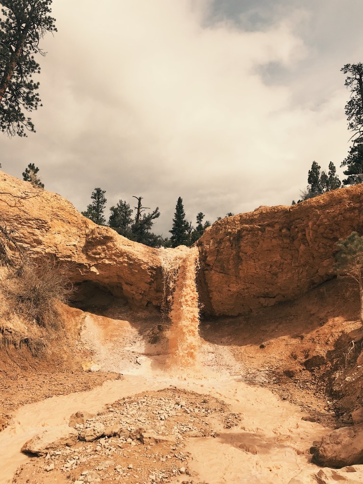
The waterfall was pretty cool but I don’t think there was an official trail to it. If there was, we aren’t very good at navigating. This hike is only 1.4 km and easy. It would be good for kids or just a quick stop.
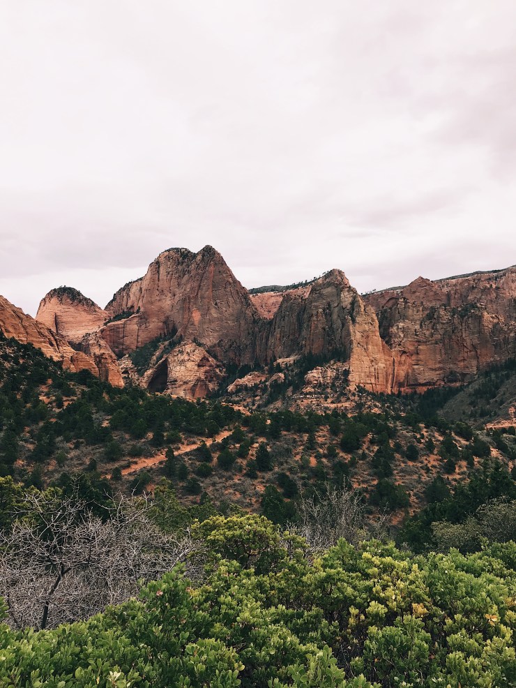
After our mini hike we were back on the road to Zion! We entered the park and drove through the Zion Mt Carmel tunnel which was really cool! The tunnel has windows that give you a sneak preview of what the scenery in the canyon looks like. Unfortunately the canyon was super packed and we couldn’t find a place to park to save our lives so we ended up driving to another section of the park called Kolob Canyons.
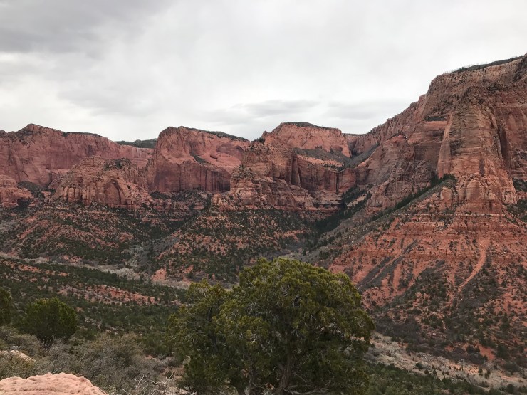
From the main park Kolob Canyons are just under an hours drive. This seemed pretty far, but we were all kind of tired and didn’t want to deal with the crowds in Springdale. We checked in with the rangers and did the scenic drive which probably took about 20 minutes. There are lots of pull offs for photo stops and unlike the main canyon it was pretty deserted!
At the end of the scenic drive there is a big parking lot where you can do the Timber Creek Overlook trail. This hike is only 1 mile and pretty easy. There are some pretty nice views of the canyons and some nearby snow capped mountains.
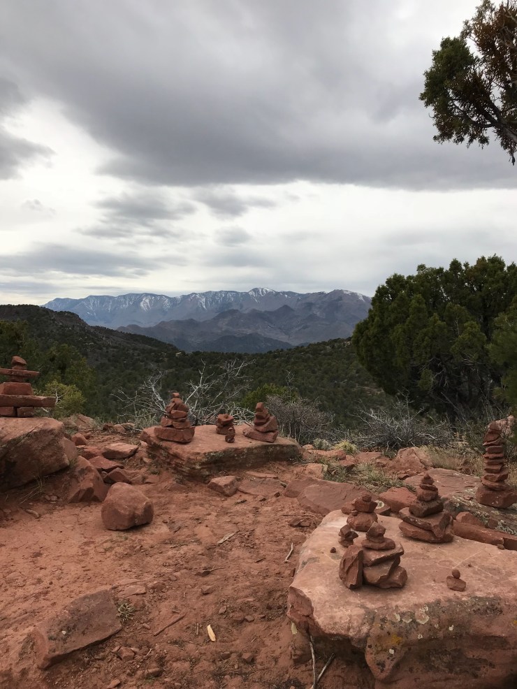
It was surprisingly chilly up here compared to Springdale so we took a few photos, hiked back to the car and headed back to Springdale to our motel and for dinner.

Blech! Ketchup, mustard or dead bugs?
